# How Drone Photography Transforms Real Estate Listings
There's a moment in every listing presentation where an agent scrolls past the interior shots and hits the aerial photo, and the buyer's entire understanding of the property changes. Suddenly they can see the size of the backyard relative to the house. They can see the cul-de-sac, the park across the street, the walking distance to the elementary school. They get context that ground-level photography physically cannot provide.
I've been flying drones for real estate clients across Orange County for years, and the before-and-after impact on listing performance is hard to overstate. Here's what aerial photography actually captures, when it's worth the investment, and what agents need to know about doing it legally.
What Drone Photography Captures That Ground Shots Can't
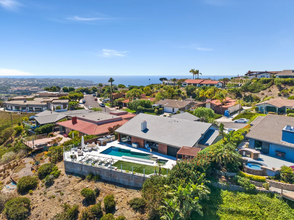
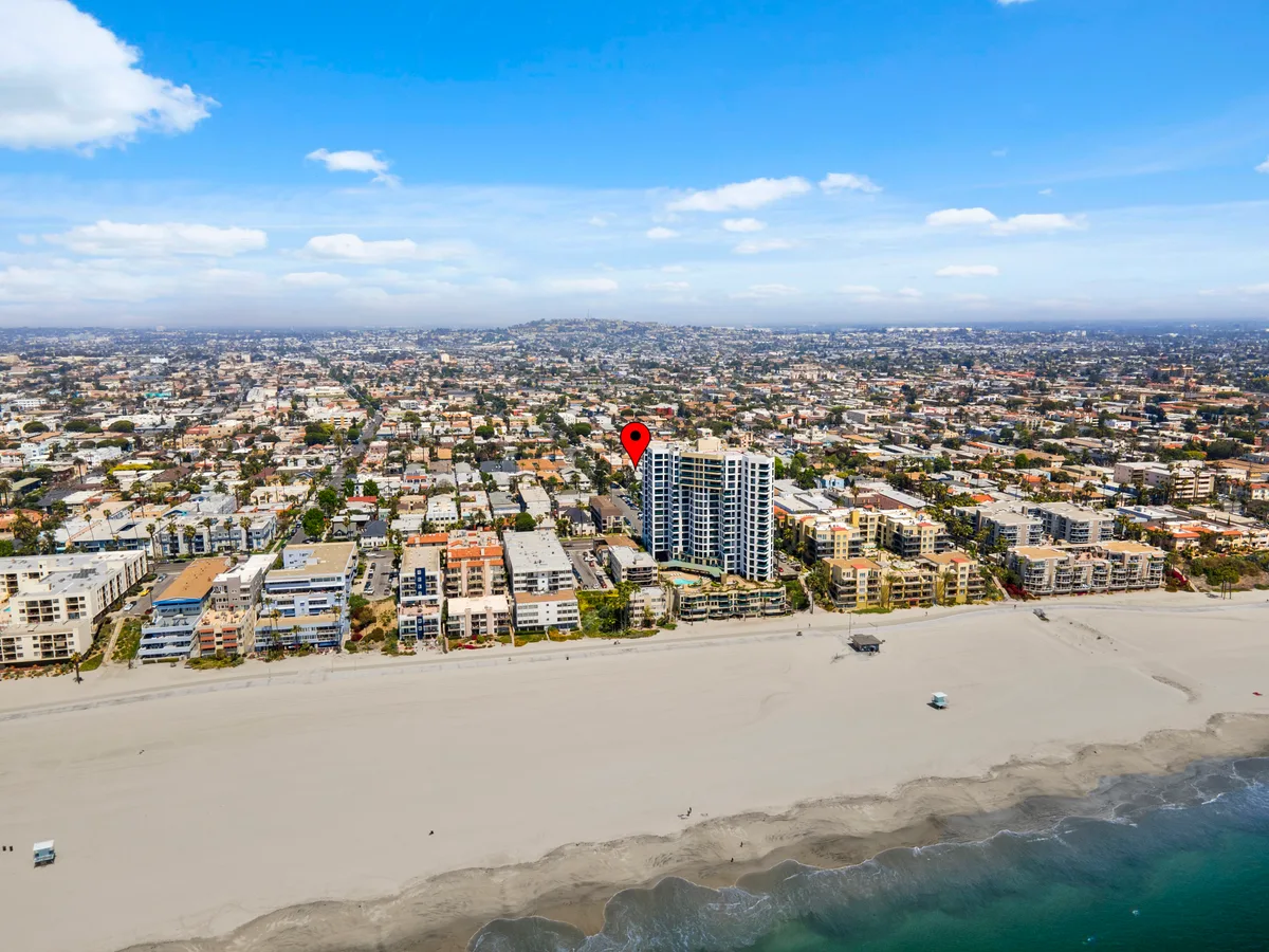
Property layout and lot size. A ground-level photo of a backyard shows you a patio and some grass. An aerial shot shows you the full lot: the pool's relationship to the house, the side yards, the mature trees, the outdoor living areas. For properties with any kind of outdoor space, this perspective is essential.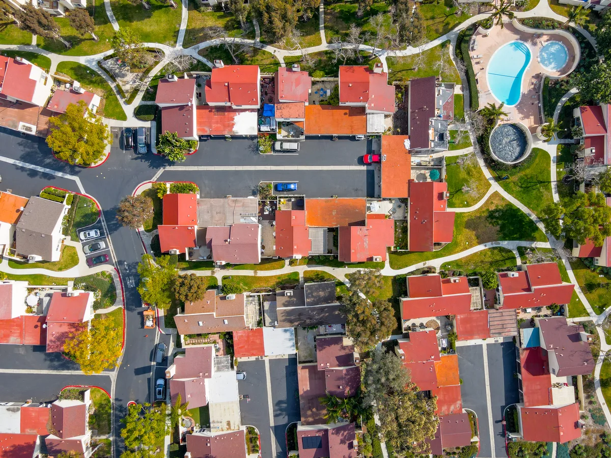 Neighborhood context. Buyers don't just buy a house. They buy a location. Drone photography shows proximity to parks, trails, shopping centers, the coast, or other amenities that matter to buyers. A home that's "walking distance to the beach" is a lot more convincing when you can see the ocean from 200 feet up.
Roof and exterior condition. While not a replacement for a home inspection, aerial photos give buyers (and their agents) a clear look at the roof condition, solar panel placement, gutters, and overall exterior maintenance. It builds confidence and reduces surprises during the inspection period.
Scale and proportion. It's genuinely hard to convey the size of a large property from the ground. Wide-angle lenses help, but nothing communicates "this is a 12,000 square foot lot" like an overhead shot that puts the entire property in frame.
Community and surroundings. For gated communities, HOA developments, or homes near golf courses and open space, drone photography shows the broader environment. Buyers relocating from out of the area especially benefit from this perspective because they can see the neighborhood character without driving through it.
Neighborhood context. Buyers don't just buy a house. They buy a location. Drone photography shows proximity to parks, trails, shopping centers, the coast, or other amenities that matter to buyers. A home that's "walking distance to the beach" is a lot more convincing when you can see the ocean from 200 feet up.
Roof and exterior condition. While not a replacement for a home inspection, aerial photos give buyers (and their agents) a clear look at the roof condition, solar panel placement, gutters, and overall exterior maintenance. It builds confidence and reduces surprises during the inspection period.
Scale and proportion. It's genuinely hard to convey the size of a large property from the ground. Wide-angle lenses help, but nothing communicates "this is a 12,000 square foot lot" like an overhead shot that puts the entire property in frame.
Community and surroundings. For gated communities, HOA developments, or homes near golf courses and open space, drone photography shows the broader environment. Buyers relocating from out of the area especially benefit from this perspective because they can see the neighborhood character without driving through it.
When Drone Photography Is Worth It
Not every listing needs drone photography. Here's my honest take on when it adds real value and when you can skip it:
Always worth it:- Single-family homes with notable outdoor space (pools, large yards, guest houses)
- Properties on large or uniquely shaped lots
- Homes near the coast, canyons, golf courses, or open space
- Luxury listings at any price point
- New construction or recently renovated exteriors
- Properties with views (hills, city lights, ocean)
- Interior condos or townhomes with no private outdoor space
- Properties in dense urban areas where aerial shots mostly show neighboring rooftops
- Entry-level listings where the marketing budget is tight and the property doesn't have standout exterior features
FAA Regulations: Why You Need a Licensed Pilot
This is the part most agents don't think about, and it matters. In the United States, any drone photography used for commercial purposes (and real estate listing photos are absolutely commercial use) must be conducted by a pilot holding an FAA Part 107 Remote Pilot Certificate.
That means:
- The pilot must pass an FAA knowledge test covering airspace classification, weather, regulations, and emergency procedures. It's not a casual exam.
- The pilot must register the drone with the FAA and carry proof of registration during flights.
- Flights must follow Part 107 rules: under 400 feet altitude, within visual line of sight, not over non-participating people, and during daylight or civil twilight with anti-collision lighting.
- Certain areas require additional authorization. Much of Orange County is near John Wayne Airport (SNA) controlled airspace. Flying commercially in these areas requires LAANC authorization, which I obtain through the FAA's automated system before every flight in restricted zones.
Why does this matter to agents? Because if your photographer is flying a drone without Part 107 certification, they're operating illegally, and the liability exposure falls on everyone involved. I've heard stories of photographers showing up with a consumer drone and no license, shooting aerials, and the agent having no idea they were breaking federal aviation regulations. Don't be that agent. Ask your photographer for their Part 107 certificate number.
I've held my Part 107 since I started offering drone services, and I stay current with recurrent testing and regulatory updates. It's a baseline professional requirement, not an optional extra.
What a Typical Drone Shoot Looks Like
A real estate drone session usually takes 20-30 minutes on site and is typically combined with the interior/exterior ground photography. Here's the process:
Pricing
Drone photography is typically included in my mid-tier and premium real estate photography packages. As a standalone add-on, aerial photography starts at $150 for a standard residential property. Drone video walkthroughs are priced separately and depend on the complexity of the flight path and editing.
For agents who shoot multiple listings per month, I offer volume pricing that makes drone a standard part of every listing package without blowing up your per-listing marketing budget.
Let's Improve Your Listings
If you're an agent in Orange County or anywhere in Southern California and you haven't been including drone photography in your listing marketing, you're giving your competition an edge you don't have to give them. The investment is modest, the impact is measurable, and the process is painless.
See the full real estate photography packages here and let's talk about your next listing.